Woodlands.co.uk

Blog - pine

immature pine cone

A variety of conifers (at Bedgebury Pinetum).

by The blog at woodlands.co.uk, 31 July, 2025, 0 comments

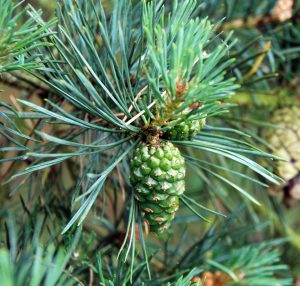
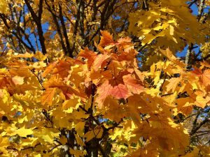
When thinking of conifers, one might feel a bit ‘schizophrenic’.  Perhaps picturing a Leylandii encroaching on your garden, whilst also remembering your Christmas tree.  Maybe the typical image of conifers is that of a tree with dark green foliage all year round.  However, this would be something of a disservice to the Conifer family - the Pinophyta, which contains an amazing variety of trees, many of which are at risk of extinction.  This group includes cedars, firs, cypresses, junipers, larches, pines, hemlocks, redwoods, spruces, and yews. [caption id="attachment_32107" align="aligncenter" width="650"] Leaves on the branchlets of Dawn Redwood[/caption] Conifers are important because 
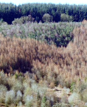
They dominate vast areas of land, particularly in the Northern Hemisphere,  forming the boreal forests or taiga. 
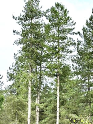
Softwood from conifers accounts for approximately 45% of global timber production. Pine, spruce and larch are often grown specifically for softwood production. The wood is also used in the paper production[.and, to a lesser extent, in making plastic from chemically treated wood pulp].  Some species produce edible seeds , such as pine nuts provide foods such as pine nuts for humans and wildlife and juniper berries, which are used to flavour gin.  The Monkey Puzzle tree, (also known as the Pehuen Pine, native to Chile and Argentina) produces seeds known as piñones; traditionally harvested by indigenous communities.  [caption id="attachment_27592" align="aligncenter" width="600"] Monkey puzzle tree[/caption] 
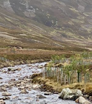
To see the diversity of the Conifer family one could visit the Bedgebury Pinetum.  This is home to one of the world’s most important conifer collections.  Bedgebury was established in 1925 by Kew Gardens and the Forestry Commission.  The curator at Kew had observed that the conifers there were ‘being choked by London Smogs’.  The site at Bedgebury, situated on the Southern Kentish weald, was ideal.  It offered an escape from the pollution of London and it had wet and free draining areas, plus varied soils so it a range of conifer could be grown. The land already had some conifers that had been planted by Viscount Beresford - an evergreen enthusiast.  In 1925, some 315 trees were planted.  This year, to celebrate reaching a century, some 89 of the original trees are marked with special yellow labels.  For  its first twenty years, the pinetum was managed by William Dallimore. His diaries record in some detail the trees he planted, and the challenges faced in establishing the pinetumIf you visit, then you might walk through through Dallimore Valley, and view his legacy. Bedgebury soon became a centre for the scientific interest in conifers, their conservation, and landscape planning.  The current curator is Dan Luscombe. Apart from seeing a range of conifers, the pinetum offers a variety of activities, e.g. family cycling, mountain biking and walking, There is also the play trail or you can explore the canopy on a Go Ape tree-top adventure or challenge.  It is rumoured that the Gruffalow lurks within the grounds of the  Pinetum. There is also a cafe, serving a range of drinks, plus  breakfast and lunch options. The pinetum is open from from 8 AM to 8 PM (March 2025 to 26 October 2025), and there are charges for car parking.  
How many trees are there in the UK?

How many trees are there in the UK?

by Angus, 1 June, 2025, 0 comments

About 3.5 billion or about 50 for each person. Yes, there’s some guesstimating but it can’t be far out.  Of course you can argue the toss about what counts as a tree and if you count tiny saplings you might get it up to 5 billion. Here’s the basis for this number - the UK is just over 60 million acres, of which about 14% is woodland.  That’s a big increase from 1900 when it was only about 5% and it’s far less than Europe where the average is almost 40%.  Anyway, suppose there are another 50% of trees outside woodlands - such as those in parks, field edges, urban trees, and on moorlands. That would be the equivalent of 12 million acres with tree cover.  How many trees per acre is a big question because large majestic trees can be so large that there can be only about 20 on each acre whereas for young saplings the number can be as high as 2,000. Conifers can be as many as 1,000 per acre but, as the tree crop is thinned, that reduces to the low hundreds. So a figure of just under 300 trees per acre looks typical and on 12 million acres that would give about 3.5 billion trees. They are not evenly distributed between different parts of the UK - for example Scotland has almost 20% tree cover and about 20M acres so of the UK’s trees, almost a third are in Scotland. That brings us onto what species these trees are. It turns out that in woodlands a quarter of the trees are Sitka spruce and half as much again are Scots pine.  Other conifers (Douglas fir, Norway spruce and Lodgepole pine) make up another 15% so over half our trees are conifers.  Of the deciduous trees English oak and Silver birch each make up another 10% or so with Beech and Hazel together making 15% of our trees. It’s a concentrated picture, with 87% of our trees being made up of the top 10 species. Whereas the British population is around a hundredth of the world’s population (1%) we are far less significant in tree terms. There are probably around 3 trillion trees worldwide so the UK has nearer to a thousandth of the trees in the world.  At least the UK is going in the right direction - whilst the world’s tree cover is reducing due to deforestation from fires, drought and agricultural expansion, the UK’s has been increasing, albeit gradually.  Since the start of the millennium we have probably increased tree cover by around 1%. [caption id="attachment_30295" align="aligncenter" width="650"] Chestnut coppice[/caption]
'Lost' pinewoods, remnants of the Caledonian Forest.

‘Lost’ pinewoods, remnants of the Caledonian Forest.

by The blog at woodlands.co.uk, 24 May, 2024, 0 comments

‘Trees for Life’ and ‘Woodland Trust Scotland’ are trying to revive lost pinewoods, that once formed part of the Caledonian Forest.  This forest supported a rich and diverse flora and fauna, including serrated wintergreen, distinctive lichens, crossbills, capercaillie, wild cats and red squirrels.   After the last Ice Age, plant and animal species moved across the 'land bridge' that connected us with continental Europe.   Pines (Scots Pine aka Pinus sylvestris) were ‘quick’ to move into Scotland and the land vacated by the glaciers.  Now less than 2% of this once great forest survives. To find pockets of ancient and ‘lost’ pine trees, these two organisations have adopted a number of approaches. Making use of old maps and texts, for example, those produced by the Reverend Timothy Pont (a Scottish minister and cartographer) in the 1500s. He was the first to produce a detailed map of Scotland.  These can point to areas that were formerly populated by “fir trees”, ie pine. Examining Gaelic place names, which might reference woodland or pine trees. Using the original ordnance survey maps (which often had fir tree symbols) to produce digital copies, which can be overlain on modern maps - hopefully to reveal former woodland sites. Using ecological evidence.  For example, wild pine often grows with old birch trees, whereas planted pine is usually found with larch and other ‘commercial conifers’. Old pine trees often have a distorted shape, with thick, gnarled and twisted trunks; they survive in remote gorges and crags.  Areas that previously supported wild pine, often have old stumps still present and / or certain distinctive lichens / plants - remnants of once diverse ecosystem. Using these various techniques, dozens of lost pine woodland areas have been identified and located.  Much of the original Caledonian Forest was lost through felling (for timber and / or fuel) over the centuries.   Later came sheep farming and this was followed in Victorian times by deer and grouse shooting.  In the last century, commercial forestry resulted in the further loss of ancient woodland. However, restoration is possible.  Where some old trees have survived, there is often a seed bank in the soil and these seeds can germinate if the dense canopy of commercial conifers is removed.  Many pine seeds that do germinate are lost as seedlings due to grazing due to deer or sheep - who seem to prefer them to Sitka etc.  Hopefully as areas with pine grow on, so other species such as rowan, birch and hazel will develop and in time a ‘full’ woodland will develop.
After-effects of forest fires.

After-effects of forest fires.

by The blog at woodlands.co.uk, 13 October, 2023, 0 comments

In 2018, the blog reported on the extensive fires in Sweden, a country noted for its forests and woodlands, which cover approximately half of the country. Once the trees were mainly broad leaved species, but then oaks and alders began to decline.  By the middle of the  twentieth century,  Spruces and Pines were dominant.  This was mainly due to forestry management, to produce wood for fuel, charcoal [used in iron smelting], potash, tar and timber (for building). Fires burnt from the extreme north down to Malmo in the south. These fires affected some 20,000 hectares and destroyed woodlands valued at [circa] £50 million.  Now work by scientists at Uppsala University, the Swedish University of Agricultural Sciences (SLU), and the Swedish Meteorological and Hydrological Institute (SMHI) have examined the effects of the fires (of 2014) in the Vastmänland province, where the fires were ferocious, burning down into the soils. They have found that the 'forested areas' continued to lose carbon for several years after the fire, and that nitrate and phosphate input to streams and rivers increased after the fires. This spring and summer have again witnessed intense and widespread fires across the Mediterranean region, Canada and the United States. Fires are a problem not only because of their immediate destructive potential, but because they result in the release of carbon dioxide - which further contributes to global warming and climate change.  The United Nations Secretary-General said recently “The era of global warming has ended; the era of global boiling has arrived.” Data on these fires is not available as yet, but studies of the boreal fires in 2021 suggest those fires released some 1.76 billion tonnes of carbon dioxide into the atmosphere.  The fires contributed nearly one quarter of world wide carbon dioxide emissions from fires in that year.  [caption id="attachment_35352" align="aligncenter" width="650"] Woodland recovering from a fire[/caption] Boreal forests store roughly twice as much carbon in their trees and soil as tropical forests.  These forests (often referred to as the Taiga) surround the Arctic Circle and research suggests the Taiga is warming faster than the global average, so areas like Northern Canada and Siberia now experience more heat and drought than in the past, and consequently are more likely to suffer from fires. Clearly, when there is a fire, carbon dioxide (and many other carbon compounds eg soot / small particles) are released by the burning of the trees but there is also the effect of fire on the soil and its organic content - the humus.   Research indicates that during the fires in the boreal area some 150 tonnes of carbon dioxide may be released into the atmosphere per hectare.  Furthermore, even after the fire, carbon continues to be lost from the soil.  It may take some three years for carbon uptake by the soil to be recorded.   Fires also lead to the rapid loss (leaching) of nutrients (e.g. phosphate) to local lakes and rivers - as there is little or no vegetation to absorb the nutrients.   Rainfall is not intercepted by vegetation and so the flow of streams increases ( sometimes by 50%).    A research paper produced by the Desert Research Institute (in Nevada) has indicated that smoke from the burning of pines has the effect of making soil particles more water-repellent.  This repellency of smoke-affected soil particles could help explain the increased flooding, erosion, and surface runoff in fire damaged areas.  

Next Page »